The key technologies of the application and why BHSoft chose them
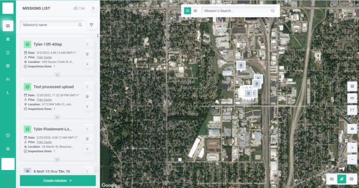
This is a multiplatform drone-based building inspection application that can examine buildings fast, efficient and automatedly. The application uses the images and data collected from drones to display 3D models, draw buildings, and provide many different machine learning-powered functions.
BHSOFT helped our client build the application to perform both primary functions: controlling the drones to take images; and processing the images to display the 3D model, draw buildings, and make related reports.
With years of experience in working with GIS-related as well as 3D projects, we completed this project with no major difficulties.
For this project, we built three different versions of the application: web app, Android and iOS. Due to the requirements of the client, we used the SDK of DJI for the drone-controlling function of the application.
For the map and building inspection functions, the key technologies are Cesium, Leaflet, Turf, and Proj4js. TurfJS was used for spatial analysis while the role of Proj4js was to transform point coordinates from one coordinate system to another.
How we utilized Cesium and Leaflet for this drone-based building inspection application
First, for the
- It’s open-source, very lightweight and requires minimal coding efforts.
- It can deal with interactive maps across many different platforms.
- It can display raster images as layers which is essential because the input data is images from drones.
With Leaflet and thanks to GIS, the application can show the exact position of the objects in real life on the interactive 2D map.
When it comes to
The strengths of Cesium are its high performance, precision, visual quality, and ease of use. So, this Cesium-powered application can easily display 3D models of any size with great details on any platform.
At BHSOFT, we have very strong teams of developers that are highly experienced with GIS applications. Working with us, we will help you build effective applications. Contact us via hello@bachasoftware.com or fill in our
Visit