Vector and Raster Data In GIS Development Services: Analysis and Comparison
The two main types of spatial data in GIS are vector and raster. These are in a GIS database to support the processing and examination of remote-sensing image data. Each has unique traits and has different needs for processing, displaying, and retaining data. In this article, we’ll discuss the key distinctions between raster and vector data and how those affect GIS development services.
Definition
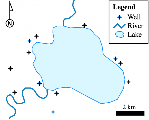
Vector data is the most common type of GIS data. Vector data uses sequential points or vertices to represent data. There are two coordinates for each vertex: x and y. Additionally, vector data uses lines, points, polygons, etc. to represent latitude and longitude.
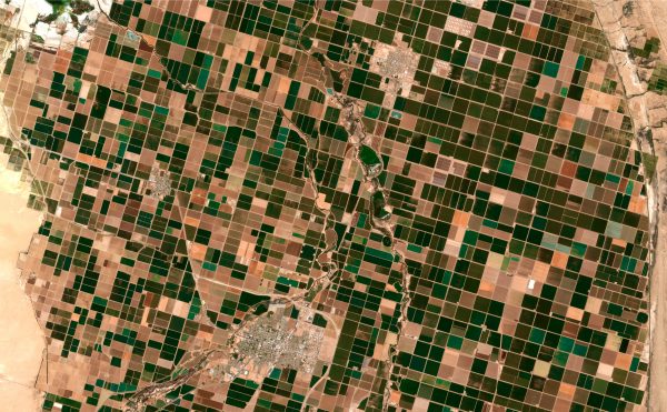
Raster data is simple. The units of raster data are pixels. Each pixel has a corresponding value. A grid of cells represents this data. In other words, it is a matrix made up of rows and columns of cells. Each cell has a value that represents information. Raster data includes things like elevation surfaces and chemical concentrations.
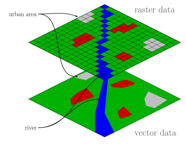
In GIS development, vector and raster data have their own specific purpose. Governmental boundaries, linear features, streets, and rivers are a few examples of vector data. Remotely sensed information, topographic and shaded relief data, satellite images, and aerial photographs all use raster data.
Difference between vector and raster data
Representation
From the previous paragraph, we can refer that the main difference between raster and vector data is the representation.
Vector data represents geographic features, including points, lines, and polygons. In GIS development services, each of them represents a specific kind of spatial data. Point data most commonly represents nonadjacent features and to represent discrete data points. Line (or arc) data represent linear features… Polygons serve as representations for places like a lake, forest, or the edge of a city on a large-scale map.
Contrarily, raster data is a type of spatial information that displays geographic features as a grid of cells or pixels. It stands for the fourth category of feature, surfaces. Continuous and discrete raster data are the two different types. Population density is an illustration of discrete raster data. Temperature and altitude readings are two examples of continuous data.
Precision
Vector data is generally more precise than raster data because vector data represents geographic features using precise points, lines, and polygons. Raster data, on the other hand, represents geographic features using a grid of pixels. Vector data can accurately represent features with very fine detail, such as curves and angles. Raster data, on the other hand, can only approximate those features based on the grid’s resolution.
Additionally, vector data is simple to edit and manipulate without compromising the data’s accuracy. Raster data, however, can lose accuracy if it is altered excessively or at a resolution that is too low. Raster data can become pixelated and lose quality when resized or reprojected, whereas vector data can be easily resized and reprojected without losing accuracy.
Scalability
Raster data suits large-scale analysis better than vector data. It is capable of handling a lot of data and covering a big area. Contrastly, vector data is more accurate and detailed, making it better suited for small-scale analysis.
Storage
Raster data requires more storage space than vector data as it consists of a large number of cells or pixels. In contrast, since vector data uses mathematical equations to represent geographic features, it takes up less storage space.
Analysis
For some types of analysis, such as terrain analysis, raster data is preferable, whereas vector data is preferable for other types of analysis, such as network analysis.
Using vector and raster data in GIS
In GIS development services, choosing between vector data and raster data depends on the specific requirements of the project or analysis. Vector data is more appropriate for representing discrete objects or features, while raster data is more appropriate for representing continuous phenomena. Here are some factors to consider.
Standard applications for vector data include:
– Accuracy is essential: Vector data is ideal for accurately representing features such as boundaries, points, lines, and polygons.
– Discrete data: Vector data is appropriate for representing data that is categorical or countable, such as administrative boundaries, land parcels, or street networks.
– Smaller datasets: Vector data is ideal for small datasets.
– Analysis that requires precise measurements or geometric calculations: Vector data can be used for analysis that requires precise measurements, such as distance or area calculations.
Raster data is typically used for:
– Continuous data: Raster data is ideal for representing data that is continuous, such as elevation or temperature.
– Large datasets: Raster data is appropriate for large datasets.
– Analysis that requires statistical calculations: Raster data can be used for analysis that requires statistical calculations, such as mean or standard deviation.
– Analysis that requires visualization: Raster data can be used for analysis that requires visualization, such as creating a heat map of temperature data.
Final thought
In sum, vector is capable of survey-level accuracy, while raster accuracy is determined by the resolution of the grid cells. Raster GIS and vector GIS operate differently and are used to address different types of geographical problems. Understanding the nature and application of each type of data will help you make the best choice for your GIS application.
BHSoft is one of the top IT outsourcing companies in Vietnam, specializing in delivering high-quality GIS applications. We provide full