An overview of GIS in agriculture
Hunger and food insecurity continue to be persistent problems globally. FAO estimates that 828 million people are experiencing undernourishment. As the world's population continues to grow, it's crucial to make sure everyone has enough food. GIS technology plays a critical role in achieving global food security. To understand how and why, let's explore an overview of GIS in agriculture in this article.
What is GIS in agriculture?
As mentioned, Geographical Information System (GIS) is software that helps collect, handle, analyze, and graphically represent massive amounts of geospatial data.
GIS in agriculture is the use of geospatial technology to collect and store data about soil properties, weather patterns, topography, and land use. By analyzing this data, GIS provides farmers with insights into how these factors impact agriculture. This enables farmers to make informed decisions, optimize resource management, increase productivity, reduce waste, and make farming more sustainable.
How does GIS work in agriculture?
Collect data
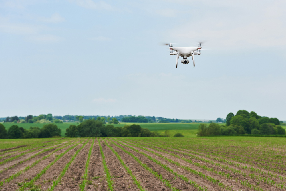
GIS technology uses various data sources, such as satellite imagery, drones, sensors, and GPS units to collect data. Farmers can use high-resolution images from satellites to monitor crop growth and identify stressed areas. Drones equipped with sensors capture data on soil and crop health, such as nutrient and moisture levels. GPS units provide information on weather patterns to help farmers optimize irrigation and prevent crop damage.
Data processing
In agriculture, GIS processing involves geoprocessing, a series of operations that produce new datasets from geographic data. The collected data, like soil samples or weather data, is organized and cleaned for accuracy before being uploaded into GIS software.
Analysis
GIS analyzes data through spatial analysis to identify patterns and trends in crop productivity, soil variability, and crop stress. It creates maps and visualizations that help farmers understand their data, including weather patterns and nutrient levels. GIS also optimizes resource use by identifying areas that require more or less water, fertilizer, or other inputs. Precision agriculture techniques can be used to apply resources more efficiently, reducing costs and improving sustainability.
Learn more: Custom software product development company in Vietnam
Ways of using GIS in agriculture
Soil analysis
By utilizing GIS technology, farmers can generate precise maps of their soil properties, including pH, nutrient content, and texture. This data can help them improve fertilization and irrigation methods, leading to better crop yields and lower costs. These maps also allow farmers to identify variations in soil quality across their fields, aiding in precision agriculture techniques.
Crop management
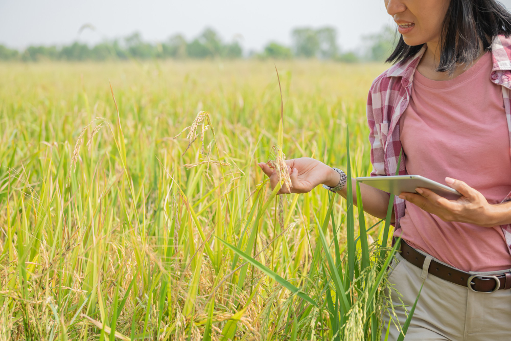
The use of GIS technology in agriculture enables farmers to keep track of their crops in real-time through various sources of data, including satellite imagery, drones, and sensors. This enables farmers to detect any early signs of issues such as disease, pest infestations, and other problems, allowing them to take corrective action before they cause significant damage. By leveraging such monitoring capabilities, farmers can maintain the health of their crops, improve their yields, and ultimately boost their profitability.
Precision farming is a technique that uses GIS technology to optimize crop inputs like water, fertilizers, and pesticides. GIS tools collect spatial data to identify variations in soil quality, crop growth, and other factors that affect crop productivity. This analysis allows farmers to apply precise amounts of inputs to specific areas of their fields, reducing waste and environmental impact. Precision farming can improve crop yields and resource management, making it a popular choice among farmers.
Land use planning
GIS technology helps farmers manage their land use patterns by analyzing various geographic data, including soil characteristics, topography, and vegetation cover. With this information, farmers can create detailed maps of their fields and plan crop rotations to improve soil health and increase crop yields.
GIS can also identify areas suitable for specific crops and conservation measures, enabling farmers to allocate resources more efficiently and manage their land sustainably. Moreover, GIS helps farmers protect natural resources, such as water and biodiversity, by monitoring water usage, identifying areas of water stress, and implementing measures to enhance conservation. By utilizing GIS technology, farmers can manage their land use sustainably and effectively.
Read more: GIS in Real Estate: Unlocking Location Intelligence for Smarter Decisions
Risk management
Farmers can use GIS technology to analyze weather patterns, soil moisture levels, and crop health data to manage risks more effectively. This data can help farmers to adjust their irrigation schedules, implement drought-resistant crop varieties, or switch to more drought-tolerant crops.
GIS technology can also assist farmers in planning for extreme weather events and making informed decisions about crop selection, planting, and harvesting. It can help farmers identify areas particularly susceptible to pests and diseases and take preventive measures to minimize crop losses.
Market intelligence
GIS technology enables farmers to access market intelligence data, which helps them to make informed decisions about crop selection and production. By analyzing market trends, supply and demand data, and consumer preferences, farmers can adjust their production plans to meet market demands, ultimately improving profitability.
Benefits of GIS in agriculture
There are several benefits of GIS (Geographic Information System) technology in agriculture, including:
Improved decision-making
GIS technology enables farmers to make better-informed decisions by providing accurate and up-to-date information on soil quality, crop health, weather patterns, and other factors affecting crop productivity.
Enhanced crop management
GIS technology can help farmers optimize resources such as water, fertilizers, and pesticides by collecting and analyzing spatial data. This can result in reduced costs, improved yields, and a more sustainable approach to farming.
Precision agriculture
GIS technology enables farmers to practice precision agriculture, which involves applying inputs such as water, fertilizers, and pesticides in precise amounts to specific areas of their fields. This can lead to improved crop yields and reduced environmental impacts.
Risk management
GIS technology can help farmers manage risks more effectively by providing information on weather patterns, soil moisture levels, and crop health. This can enable farmers to plan for extreme weather events, such as floods and droughts, and make informed decisions about crop selection, planting, and harvesting.
Natural resource management
GIS technology can assist farmers in managing natural resources such as water and biodiversity by identifying areas that require conservation measures and implementing sustainable land use practices. This can help preserve natural habitats and promote biodiversity.
Conclusion
In sum, the use of GIS in agriculture is opening up new opportunities for farmers and the industry. With continuous advancements in technology, the agricultural sector can move towards a more sustainable future, benefiting both farmers and consumers alike.
At Bac Ha Software, we are committed to creating software solutions that enhance agricultural technology. Our team can assist you in developing customized GIS software that meets all of your unique requirements. Get in touch with us today to learn more about our GIS development services.