Home > Blog > IT Business
GIS in Real Estate: Unlocking Location Intelligence for Smarter Decisions
12 minutes read
Audio description available
January 24, 2025
In today's dynamic real estate market, location intelligence is crucial. Making informed decisions requires more than gut instinct and traditional market analysis. Therefore, professionals use Geographic Information Systems (GIS). GIS in real estate empowers them to make informed decisions, gain a competitive edge, and maximize ROI by providing the tools and insights to analyze data spatially and uncover hidden patterns.
This blog post explores how this powerful technology can revolutionize your real estate strategies and propel your business forward.
1. Overview of GIS in Real Estate
1.1. What is GIS?
Geographic Information Systems (GIS) are powerful technologies that allow us to visualize, analyze, and understand the world through location-based data. In real estate, GIS takes the concept of location to a whole new level. It's not just about where a property is; it's about understanding the surrounding environment, market dynamics, and other critical factors influencing its value and potential.
By embracing GIS, businesses gain a deeper understanding of market dynamics, identify opportunities, and mitigate risks, ensuring sustainable growth in this competitive landscape. The rise of big data, cloud computing, and the demand for transparency further amplify the importance of GIS in real estate.
Explore GIS in detail through this article: GIS Application Development: A Complete Guide.
1.2. Key Components of GIS in Real Estate
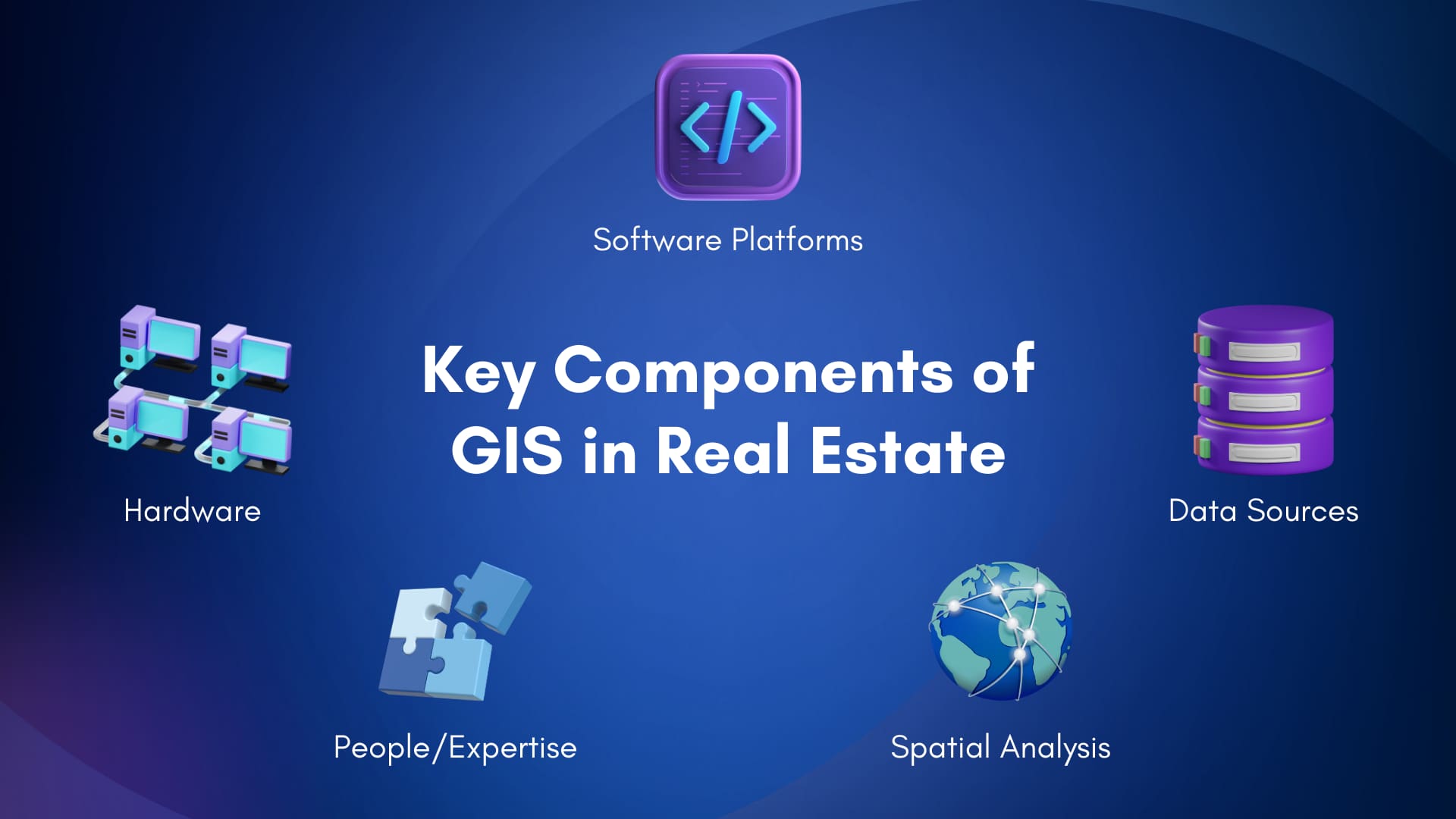
These work together to provide a powerful framework for understanding and interacting with the complex world of real estate.
Software Platforms: GIS software platforms, such as ArcGIS and QGIS, provide the foundation for creating, visualizing, and analyzing geospatial data. These platforms offer a range of functionalities, from mapping and data management to spatial analysis and 3D visualization.
Data Sources: GIS integrates diverse data sources, including property records, demographics, environmental data, market trends, and amenities, to create a comprehensive view of the real estate landscape.
Differences between Vector and Raster Data in GIS
Spatial Analysis Techniques: Spatial analysis, including proximity, overlay, and suitability analysis, is core to GIS. These techniques uncover hidden patterns, relationships, and opportunities within real estate data.
People/Expertise: Effective GIS application requires skilled professionals. They interpret data, perform complex analyses, and translate results into actionable insights, tailoring solutions to specific real estate challenges.
Hardware (Supporting Infrastructure): While often hidden, hardware like powerful computers, servers, and mobile devices is essential for running GIS software and processing large datasets. Specialized hardware like GPS receivers and drones can also help with data acquisition and field surveys.
Read more about Drone: Drone Mapping: A Comprehensive Guide.
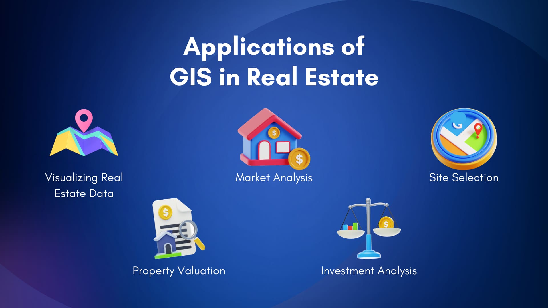
2. Applications of GIS in Real Estate
2.1. Visualizing Real Estate Data
GIS provides the tools to transform complex data into clear, compelling visuals that enhance understanding, facilitate communication, and empower better decision-making.
Here are some key visualization techniques used in GIS in real estate:
Interactive Maps: They enable users to explore properties dynamically, analyze surrounding areas, and visualize market trends. Users can zoom, pan, and click on features for detailed information. Examples include visualizing property boundaries, amenities, and market hotspots with heat maps.
3D Models: They offer immersive views of properties and developments, enabling visualization of proposed projects, analysis of site topography, and assessment of potential impacts of new construction. They enhance stakeholder engagement and communication.
Data Dashboards: Dashboards integrate visualizations to provide a comprehensive overview of key metrics and performance indicators. Real estate professionals can use them to track trends, monitor property performance, and effectively manage portfolios.
Regular charts and graphs can also be created, making it favorable to draw meaningful conclusions.
By leveraging these visualization techniques, real estate professionals can:
Gain a deeper understanding of complex data: Visualizations reveal patterns and relationships that might be missed in traditional reports.
Communicate information more effectively: Compelling visuals are more engaging and easier to understand for non-technical audiences. Therefore, they make presentations and marketing efforts more persuasive and impactful.
Learn more about visualization in GIS in this article: How Geospatial Data Visualization Impacts Your Business.
In the following sections, we'll explore how these visualization techniques are applied in specific real estate applications, demonstrating their power to transform data into actionable insights.
2.2. Market Analysis
By leveraging the data sources and spatial analysis techniques discussed earlier, professionals can gain a much deeper understanding of market dynamics and identify lucrative opportunities. Here's how it can be applied in market analysis:
Identifying Profitable Locations for Development: GIS helps pinpoint optimal locations for new projects by analyzing demographic trends, market demand, and proximity to amenities. For example, a developer could use GIS to identify areas with a growing young professional population and easy access to transportation.
Analyzing Demographics and Market Trends: GIS enables the visualization and analysis of demographic data, revealing patterns and trends that inform targeted marketing campaigns and development strategies.
Assessing Competition and Market Saturation by analyzing spatial data. This includes identifying market share distribution and pinpointing underserved areas with growth potential.
Visualization in Action:
Heat maps: Visualize market hotspots, identifying areas with high demand or rapidly increasing property values.
Choropleth maps: Display demographic data and market trends by geographic area, revealing patterns and variations across different neighborhoods or regions.
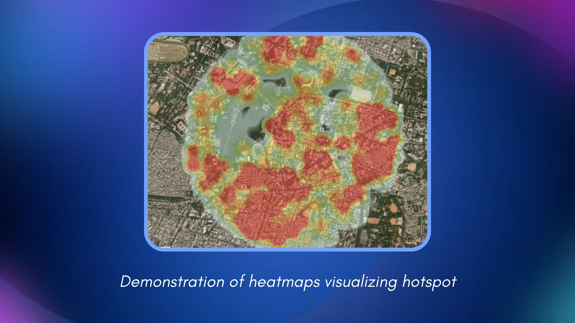
Source: PREDIK Data-Driven
2.3. Site Selection
GIS plays a crucial role in real estate by providing the tools to analyze various factors impacting a property's suitability and potential.
Analyzing Proximity to Amenities and Infrastructure: The proximity to essential amenities and infrastructure significantly impacts a property's value and desirability. GIS allows for analysis of the distance and accessibility to schools, hospitals, shopping centers, parks, utilities (water, electricity, sewer), and other key infrastructure components. This analysis helps determine the suitability of a site for specific types of development, whether it's a residential community, a commercial complex, or an industrial facility.
Assessing Accessibility and Transportation Networks: GIS allows real estate professionals to analyze road networks, public transportation routes, and traffic patterns. This is crucial for understanding how easily potential customers, residents, or employees can reach a site. Analyzing drive times, public transit accessibility, and pedestrian walkways can significantly influence site selection decisions.
Experts can make decisions based on data-driven insights, maximizing the potential for success and minimizing the risks of choosing the wrong location. This leads to more efficient use of resources, better investment outcomes, and ultimately, more successful real estate projects.
Visualization in Site Selection:
3D models: Visualize proposed developments in their real-world context, considering topography, surrounding buildings, and environmental factors.
Proximity analysis maps: Show distances to amenities, transportation, and other points of interest.
Suitability analysis maps: Identify optimal locations based on predefined criteria, such as zoning regulations or environmental constraints.
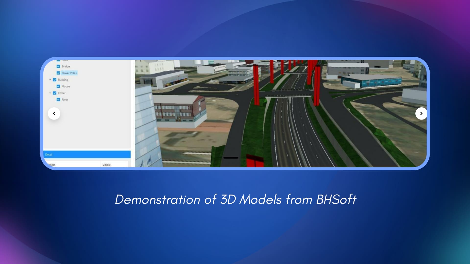
Source: our case study on Facilities - Accesses Management System
2.4. Property Valuation
GIS in real estate offers advanced tools and techniques to determine property values based on a comprehensive analysis of location-based data and surrounding factors, moving beyond traditional appraisal methods.
Determining Property Values Based on Location and Surrounding Factors: GIS allows appraisers to consider factors influencing property value, including proximity to amenities, access to transportation, views, neighborhood characteristics, and environmental conditions. By incorporating these spatial factors into the valuation process, GIS provides a more nuanced and accurate assessment of a property's worth.
Identifying Comparable Properties for Accurate Valuations: GIS helps locate properties with similar characteristics, considering physical and location-based factors like proximity to amenities and access to transportation. This ensures a more apples-to-apples comparison and leads to more reliable valuation estimates.
By doing this, appraisers can generate more accurate and comprehensive valuations, benefiting buyers and sellers and facilitating more efficient real estate transactions. This data-driven approach provides greater transparency and builds trust in the valuation process.
Visualization in Property Valuation:
Charts and graphs: Illustrate the impact of location-based factors on property values.
Interactive maps: Explore surrounding amenities and neighborhood characteristics that influence value.
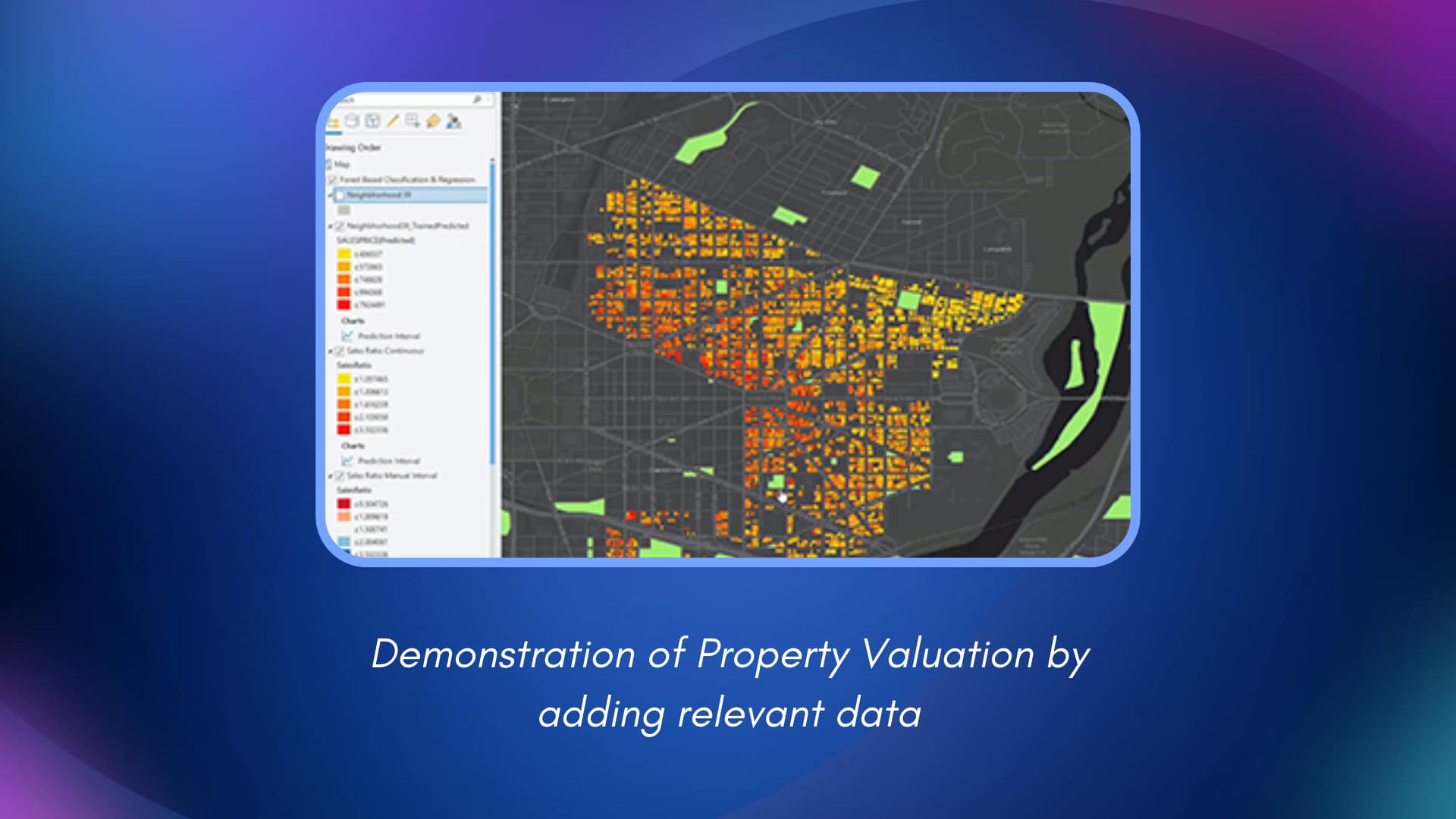
Source: Esri
2.5. Investment Analysis
GIS plays a crucial role in real estate investment analysis by providing the tools and insights needed to assess potential returns, evaluate risks, and develop optimal investment strategies.
Analyzing Potential Return on Investment (ROI): GIS helps investors analyze various factors contributing to ROI, including property values, rental income potential, operating expenses, and market trends. By combining these factors with spatial analysis, investors can identify properties and locations with the highest return potential.
Optimize Investment Portfolios: Leverage GIS to analyze the geographic distribution and performance of your existing real estate portfolio. Identify areas for diversification, optimize asset allocation, and make strategic decisions to maximize overall portfolio performance.
By leveraging the power of GIS, real estate investors can make more informed decisions, optimize their portfolios, and achieve higher returns while minimizing risk.
Visualization in Investment Analysis:
Portfolio maps: Visualize the geographic distribution of investments and identify areas for diversification.
ROI maps: Display potential return on investment for different properties or locations.
3. Benefits of Using GIS in Real Estate
Using GIS technology offers a wide range of benefits for real estate professionals, transforming how they operate and compete in the market.

3.1. Improved Decision-Making
GIS empowers professionals to make more informed decisions based on data-driven insights rather than guessing. By providing access to comprehensive data and powerful analytical tools, GIS enables better assessment of opportunities, risks, and potential outcomes, leading to more strategic and successful outcomes.
3.2. Increased Efficiency and Productivity
GIS streamlines workflows, automates tasks, and optimizes resource allocation, leading to increased efficiency and productivity. Tasks like site selection, market analysis, and property valuation can be performed more quickly and accurately, freeing up valuable time and resources.
3.3. Enhanced Market Understanding
GIS provides a deeper understanding of market dynamics, trends, and demographics. Spatial analysis of market data empowers real estate professionals to pinpoint emerging opportunities, predict market shifts, and adapt their strategies accordingly.
3.4. Reduced Risks and Improved ROI
By providing insights into potential risks associated with specific locations and investments, GIS helps mitigate those risks and maximize return on investment. This data-driven approach enables more informed investment decisions and reduces the likelihood of costly mistakes.
3.5. Better Communication and Collaboration
GIS facilitates better communication and collaboration between real estate agents, clients, investors, and other stakeholders. Interactive maps, data visualizations, and online platforms enable seamless information sharing and enhance transparency, fostering stronger relationships and more effective communication. Clients gain more engaging visualizations of properties and their surroundings, while agents can effectively communicate complex market data and investment opportunities.
4. GIS in Real Estate: A Practical Application
CoStar Group exemplifies how GIS is reshaping commercial real estate information and analytics. Their services and online platforms demonstrate the extensive integration of GIS technology to deliver powerful market intelligence and insights.
Here's how they leverage GIS:
Comprehensive Data Integration: CoStar aggregates vast amounts of data from diverse sources—public records, market transactions, proprietary research—and integrates it spatially using GIS. This provides a holistic market view that goes beyond basic property information.
Actionable Market Analysis: CoStar utilizes GIS to generate in-depth market reports, analyzing trends in property values, vacancy rates, rental income, and other key indicators. Interactive maps and visualizations empower clients to understand market dynamics at a glance and identify emerging opportunities.
Precise Property Search and Evaluation: CoStar provides robust GIS-powered mapping and search tools. Users can visualize properties, analyze surrounding demographics and amenities, assess proximity to transportation, and evaluate market conditions within specific geographic areas, all crucial factors in real estate decisions.
As the CoStar example demonstrates, leveraging GIS in real estate can drive success in the industry. By providing clients with powerful location intelligence, CoStar empowers them to make informed decisions, navigate market complexities, and achieve greater success.
However, building and maintaining in-house GIS capabilities can be complex, requiring spending on software, hardware, training, and specialized personnel. Partnering with a dedicated GIS service provider can be a game-changer.
5. Our GIS Services for Real Estate
BHSoft empowers real estate with GIS solutions. We provide expertise, technology, and support, enabling you to leverage location intelligence without the burden of in-house management. Our team of GIS engineers delivers streamlined data analysis, robust software, and flexible service models to boost your performance and drive success.
Our tailored GIS solutions for real estate include:
Map Making and Geographic Display: We transform complex data into clear, interactive maps, providing a comprehensive visual understanding of market trends, property locations, demographics, and surrounding amenities. This empowers you to make informed decisions based on spatial relationships and market dynamics.
Geographical Determination and Location (LBS): Leverage the precision of Location-Based Services to analyze site accessibility, proximity to key points of interest, and transportation networks.
Systems for Routing and Navigation: Intelligent routing and navigation solutions optimize logistical operations and analyze transportation accessibility. This is essential for assessing property connectivity and understanding traffic patterns that impact property values and market appeal.
GIS Data Management: Our robust data management solutions ensure your geospatial data is organized, secure, and readily accessible, providing a solid foundation for all your real estate GIS applications. Efficient data management streamlines workflows and empowers informed decision-making.
Conclusion
In today's competitive real estate landscape, harnessing the power of location intelligence is no longer optional—it's essential. GIS provides the tools and insights to make informed decisions, optimize investments, and achieve sustainable growth. From market analysis and site selection to property valuation and risk assessment, GIS empowers real estate professionals to navigate market complexities and unlock new opportunities.
Ready to transform your real estate business with the power of location intelligence? Contact BHSoft today to explore how our customized GIS solutions can help you achieve your goals and thrive in today's dynamic market.