GIS Development Services: 5 Essential Application Components To Lower Operating Cost
Geographic Information Systems (GIS) are transforming the way organizations operate and make data-driven decisions. From urban planning and agriculture to logistics, defense, and public health, GIS technology plays a vital role in optimizing workflows and visualizing complex spatial data. As digital transformation accelerates, the demand for GIS development services has grown rapidly, empowering businesses with deeper spatial insights and smarter decision-making capabilities.
In this article, BHSoft — a leading software outsourcing company in Vietnam — explores the essential components of a cost-efficient GIS application and how businesses can leverage these tools to gain a competitive advantage.
What Is a GIS Application?
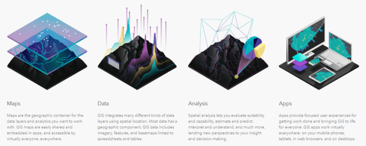
A Geographic Information System (GIS) is software designed to collect, manage, analyze, and visualize geospatial data. It combines geographic coordinates (location) with attribute data (descriptive information about features) and presents them in visual formats such as maps or 3D models.
Each GIS development service typically follows four main stages:
– Generating or capturing spatial data
– Managing data
– Analyzing data
– Visualizing data on the map
These stages help organizations transform raw data into actionable insights — driving smarter planning, optimized resource allocation, and lower operating costs.
Learn more: Application development outsourcing company in Vietnam

Applications of GIS Development
GIS solutions have become indispensable across multiple sectors. From governments and NGOs to private enterprises, organizations rely on custom GIS software to enhance situational awareness, improve decision-making, and optimize resource management.
Common GIS use cases include:
– Mapping locations, their attributes, and their connections
– Identify problems
– Perform forecasting
– Quantity and density mapping
– Manage and respond to events
– Set priorities
Learn more: Custom mapping services for enterprises
Top 5 Essential Components of GIS Development Services
To deliver maximum business value and cost efficiency, every GIS application should incorporate the following five key components:
1. Remote Sensing
Modern GIS applications integrate data from various sensors mounted on drones, satellites, and aircraft. Using technologies like radar, LiDAR, and scatterometers, remote sensing provides accurate, real-time environmental data.
It helps detect changes in land use, assess potential construction sites, monitor environmental risks, and analyze urban growth — all of which support informed decision-making and cost optimization.
2. Real-Time GIS
Real-time GIS enables immediate data processing and analysis from multiple sensors and IoT devices. This empowers organizations to react quickly to changing conditions, reduce downtime, and minimize risk.
By applying location-based analytics, companies can automatically highlight the most relevant events and make faster, smarter operational decisions — a crucial factor in industries such as logistics, agriculture, and energy.
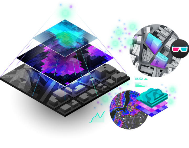
3. 3D GIS
Adding a third dimension takes spatial visualization to the next level. 3D GIS applications help represent not just where something is, but also how it appears and interacts within its environment.
From modeling urban density and mineral deposits to simulating traffic flows and autonomous vehicle navigation, 3D GIS unlocks deeper spatial insights and enhances predictive modeling capabilities.
4. Mapping and Visualization
Modern GIS mapping solutions use layered visualizations to represent diverse datasets. This approach supports geo-visualization—creating, analyzing, and managing visual data across maps, charts, 3D scenes, and diagrams.
Such functionality is invaluable in asset management, urban planning, and facility maintenance, giving decision-makers an intuitive understanding of spatial relationships.
5. Spatial Analysis
GIS spatial analysis allows businesses to identify trends, measure performance, and predict future scenarios using big data and IoT-driven analytics.
Whether optimizing supply chain networks, enhancing market planning, or monitoring competitor activity, spatial analytics offers critical insights that help organizations lower costs and improve efficiency.

Partner with a Leading Software Outsourcing Company for GIS Development
BHSoft is a trusted software outsourcing company in Vietnam, specializing in GIS development services and BIM application development. With nearly a decade of experience in building advanced 3D and 4D GIS solutions, our team helps clients across industries transform spatial data into powerful business tools.
Our expertise includes:
– GIS & BIM integration service
– 3D & 4D web application using WebGL, Three.js
– 3D & 4D product configurators
– Facilities management
– 3D floor plan
– 3D interactive presentation
As a Cesium Certified Developer, BHSoft continues to deliver innovative and high-performance GIS solutions tailored to your unique business needs.
If you have a vision for your next GIS project, let’s bring it to life together.
Contact BHSoft today to discover how our GIS Development Services can help you reduce costs, improve operational efficiency, and accelerate digital transformation.